The following data products were used in the creation of this demo:
- Address Fabric
- GeoEnrichment Floods
- GeoEnrichment Fire
- Risk Data Suite
- Property Attributes Ultimate – GeoEnrichment
- Precisely Buildings
- Parcel Boundaries
- Precisely Data Experience
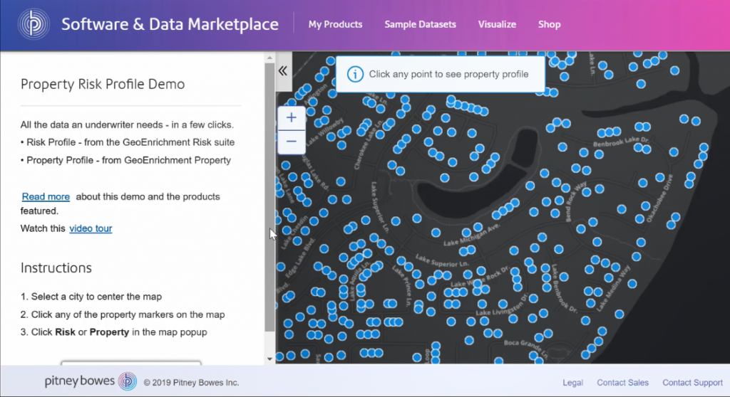
Demo Description
This demo was created for insurance underwriters looking to understand the risk profile and property value of a new policy. Calculating just the right premium helps you safely grow your book of business while staying competitive. The data featured in this demo includes:
- The Risk Data Suite – earthquake, flood, weather, property, wildfire, and coastal risk lookup provides a comprehensive risk profile
- Parcel Boundaries and GeoEnrichment Property Attributes – provide information underwriters need about the property in order to insure it
- US Buildings – provides information about the structures on the property
This demonstration was built to show the value of combining Precisely data sets to solve specific, common use cases and to make the Precisely Data Experience more than a map viewer with a long list of data sets. It also does an excellent job of showing the link between PreciselyID and Buildings, Parcels, and Addresses for our geofencing use cases (i.e. they have an app or a device that is capturing mobile signals and want to associate that data by brand or competitor).
Click the image to view a video walkthrough of the demo, or click here.
To access the demo itself please visit the Precisely Data Experience.